Log in
All resources
Create a design
1,197 Free Images of Hand Made
prints in musée carnavalet
baroque
la tigresse (vase you 卣)
henry monnier
prints by abraham bosse
abraham bosse
grandville (caricaturist)
hippolyte bellangé
dutch golden age painting
artist in oriental costume with poodle (rembrandt)
henry monnier
engravings in musée carnavalet
symbolism
prints in musée carnavalet
prints by abraham bosse
henry monnier
chansons de béranger (monnier)
henry monnier
schetsboek met 117 bladen, van esaias boursse
esaias boursse
prints in musée carnavalet
prints by abraham bosse
emile-charles wattier
collections of maison de balzac
symbolism
drawings in musée carnavalet
symbolism
prints in musée carnavalet
prints by abraham bosse
henry monnier
drawings in musée carnavalet
symbolism
prints in musée carnavalet
prints by abraham bosse
prints in musée carnavalet
prints by abraham bosse
henry monnier
bernard (surname)
henry monnier
henry monnier
chansons de béranger (monnier)
les grisettes (monnier)
prints in musée carnavalet
order of the holy spirit
drawings of maison de victor hugo
academic art
prints by william dent in the british museum
satirical prints in the british museum
collections of maison de balzac
auguste desperet
prints in musée carnavalet
hippolyte bellangé
prints in musée carnavalet
prints by abraham bosse
henry monnier
henry monnier
prints in musée carnavalet
hippolyte bellangé
prints in musée carnavalet
hippolyte bellangé
prints in musée carnavalet
hippolyte bellangé
prints in musée carnavalet
hippolyte bellangé
prints in musée carnavalet
hippolyte bellangé
antiquities of russian country - volume iii
prints in musée carnavalet
prints by abraham bosse
prints in musée carnavalet
hippolyte bellangé
prints in musée carnavalet
hippolyte bellangé
prints in musée carnavalet
prints by abraham bosse
drawings in musée carnavalet
jean-baptiste lesueur
prints in musée carnavalet
hippolyte bellangé
prints in musée carnavalet
hippolyte bellangé
henry monnier
la tigresse (vase you 卣)
baroque
drawings by jean-baptiste oudry
foxes acting as humans in art
17th-century portrait paintings of unidentified women
female portrait paintings by gerard soest
prints by william dent in the british museum
satirical prints in the british museum
les embelissements de paris
prints in musée carnavalet
henry monnier
henry monnier
family portraits of russian rulers
confirmation in art
collections of maison de balzac
camille de montalivet
the illustrated london news 1855
joseph archer crowe
18th-century oil oval portraits of women at half length
female portrait paintings by johann georg ziesenis
la tigresse (vase you 卣)
baroque
la tigresse (vase you 卣)
baroque
la tigresse (vase you 卣)
baroque
la tigresse (vase you 卣)
baroque
la tigresse (vase you 卣)
baroque
artist in oriental costume with poodle (rembrandt)
dutch golden age painting
la tigresse (vase you 卣)
baroque
artist in oriental costume with poodle (rembrandt)
dutch golden age painting
la tigresse (vase you 卣)
baroque
la tigresse (vase you 卣)
baroque
artist in oriental costume with poodle (rembrandt)
dutch golden age painting
la tigresse (vase you 卣)
baroque
la tigresse (vase you 卣)
baroque
la tigresse (vase you 卣)
baroque
la tigresse (vase you 卣)
baroque
la tigresse (vase you 卣)
baroque
la tigresse (vase you 卣)
baroque
artist in oriental costume with poodle (rembrandt)
dutch golden age painting
artist in oriental costume with poodle (rembrandt)
dutch golden age painting
drawings of maison de victor hugo
albert maignan
emile-charles wattier
la tigresse (vase you 卣)
baroque
la tigresse (vase you 卣)
baroque
la tigresse (vase you 卣)
baroque
artist in oriental costume with poodle (rembrandt)
dutch golden age painting
artist in oriental costume with poodle (rembrandt)
dutch golden age painting
la tigresse (vase you 卣)
baroque
artist in oriental costume with poodle (rembrandt)
dutch golden age painting
artist in oriental costume with poodle (rembrandt)
dutch golden age painting
les images de tous les saincts et saintes de l'année, suivant le martyrologe romain
symbolism
singeries
view of brussels by abraham dircksz. santvoort, after nicolaas van der horst
prints of cartouches in the rijksmuseum amsterdam
collections of maison de balzac
jean-pierre dantan
henry monnier
daswanth
basawan
prints by william hogarth in the british museum
realism
prints by william hogarth in the british museum
realism
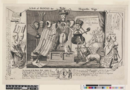
a sett of blocks for hogarth's wigs
prints in the british museum
prints in musée carnavalet
prints by abraham bosse
collections of maison de balzac
symbolism
prints in musée carnavalet
prints by abraham bosse
collections of maison de balzac
symbolism
collections of maison de balzac
symbolism
1101 - 1197 of 1,197
/ 12